June 29, 2014

Credits: NASA/JPL/Arizona State University (ASU) - Credits for the additional process. and color.: Dr Paolo C. Fienga/Lunar Explorer Italia/IPF
|
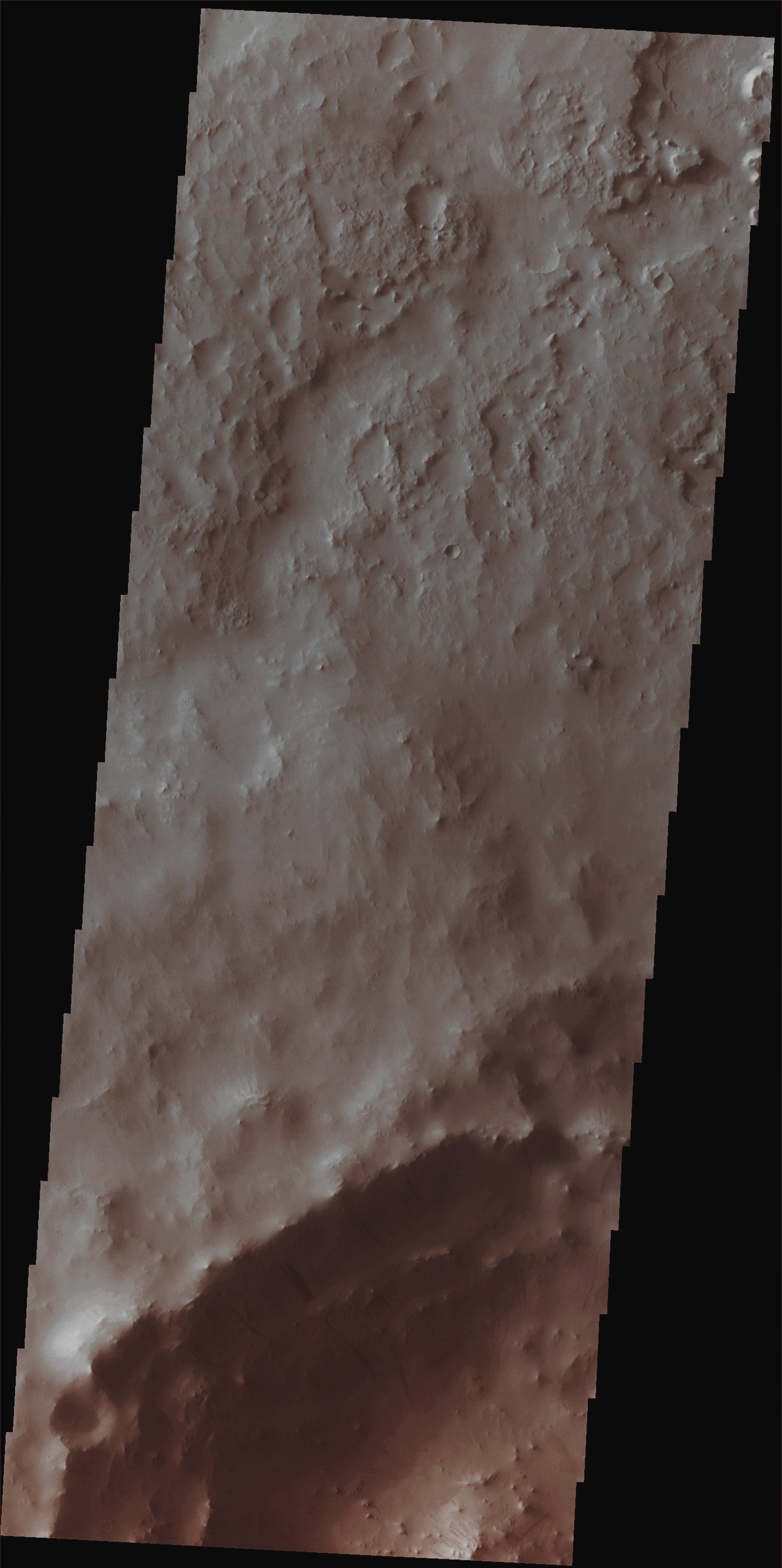
In this VIS image, taken by the NASA - Mars Odyssey Orbiter on April, 15th, 2014, and during its 54.715th orbit around the Red Planet, we can see very faint and (relatively) dark Slope Streaks (probably caused by very thin Sand and Dust Displacement due to the occurrence of a Gravity Wasting Event or, but this second hypothesis - in our opinion, as IPF - is more unlikely, by the verification of a phenomenon known as Seepage) that mark the North/Western portion of the Inner Rim and Slopes of an ancient Unnamed Impact Crater located in the Martian Region known as Terra Sabaea. Latitude (centered): 13,3858° North This image (which is an Original Mars Odyssey Orbiter b/w and Map-Projected frame published on the NASA - Planetary Photojournal with the ID n. PIA 18495) has been additionally processed, magnified to aid the visibility of the details, contrast enhanced and sharpened, Gamma corrected and then colorized in Absolute Natural Colors (such as the colors that a human eye would actually perceive if someone were onboard the NASA - Mars Odyssey Orbiter and then looked down, towards the Surface of Mars), by using an original technique created - and, in time, dramatically improved - by the Lunar Explorer Italia Team. |
News visualized: 794 times