February 24, 2014

Credits: NASA/JPL/Arizona State University (ASU) - Credits for the additional process. and color.: Dr Paolo C. Fienga/Lunar Explorer Italia/IPF
|
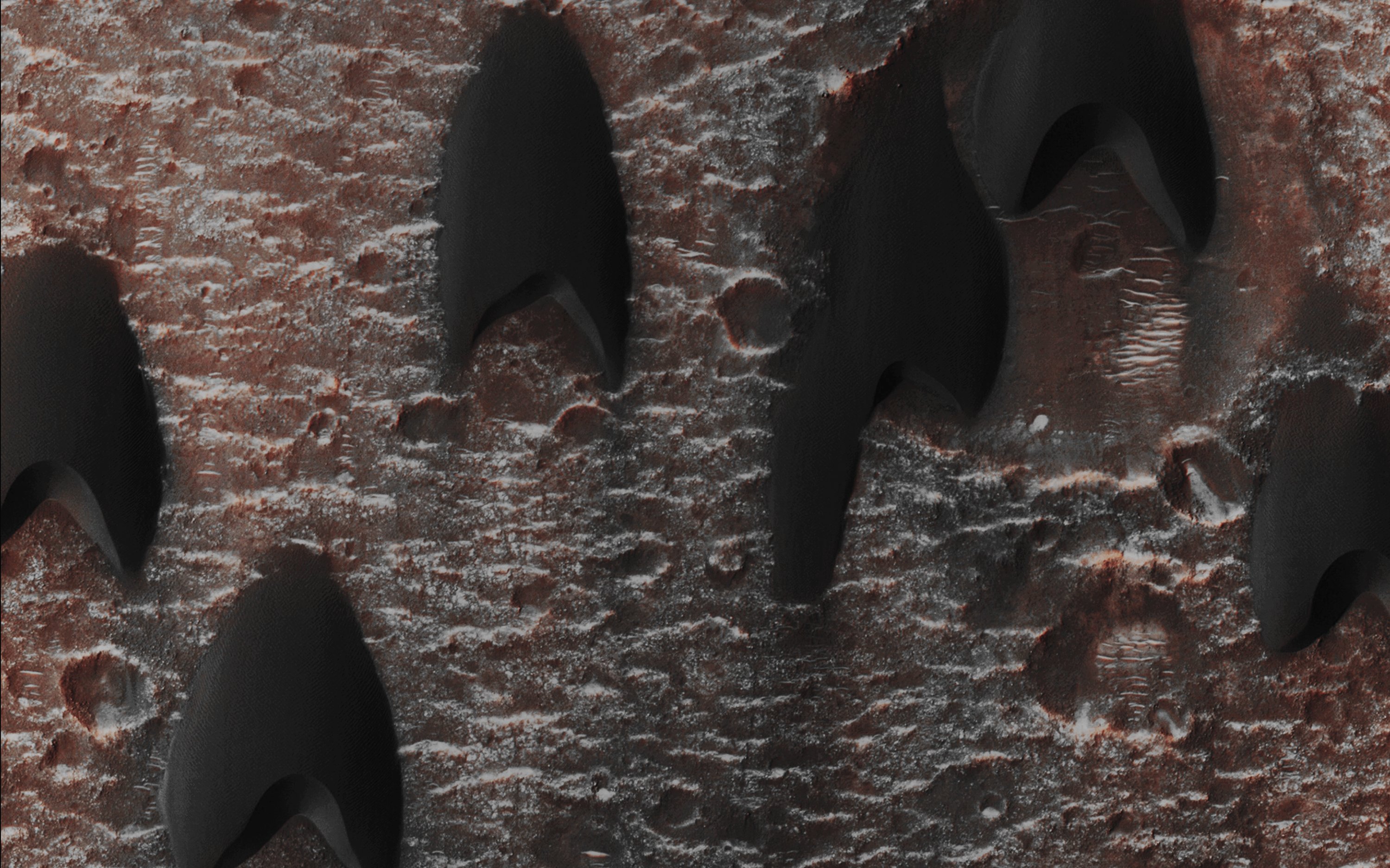
Migratory birds and military aircrafts — like it happened during the World War II — often fly in a "V-shaped Formation". Why? Because the “V”-shaped Formation greatly boosts the efficiency and range of the flying birds (and aicrafts), because all of them (obviously, except the first one) move in (and take advantage of) the upward motion of the air - a phenomenon known as "Upwash" - that comes from the wingtip vortices that is created by the bird and/or the aicraft ahead. Now, In this image of a Dunefield - which is located in a large Impact Crater near to the huge and long Outflow Channel known as Mawrth Vallis -, some of the Dunes appear, in fact, as they were actually positioned in some sort of Formation (NOT a "V"-shaped Formation, anyway). For the Dunefields, however, the space (---> distance) existing between each and every one of the individual Dunes - unlike it occurs for the abovementioned birds and aicrafts - is a function related to the Sand Supply, the (average - considering the location where they stand) Wind Speed (as well as its direction) and, of course, the Surface Topography where, sometimes, they can also move (---> in this last case, we talk about the so-called "Migrating Dunes and/or Dunefields"). Mars Local Time: 15:03 (Early Afternoon) This picture (which is a NASA - Original Mars Reconnaissance Orbiter false colors and NON-Map Projected sub-frame identified by the serial n. ESP_034815_2035-1) has been additionally processed, magnified to aid the visibility of the details, contrast enhanced, Gamma corrected, and then colorized in Absolute Natural Colors (such as the colors that a human eye would actually perceive if someone were onboard the NASA - Mars Reconnaissance Orbiter and then looked down, towards the Surface of Mars), by using an original technique created - and, in time, dramatically improved - by the Lunar Explorer Italia Team. |
News visualized: 767 times