December 2, 2013

Credits: NASA/JPL/Arizona State University (ASU) - Credits for the additional process. and color.: Dr Paolo C. Fienga/Lunar Explorer Italia/IPF
|
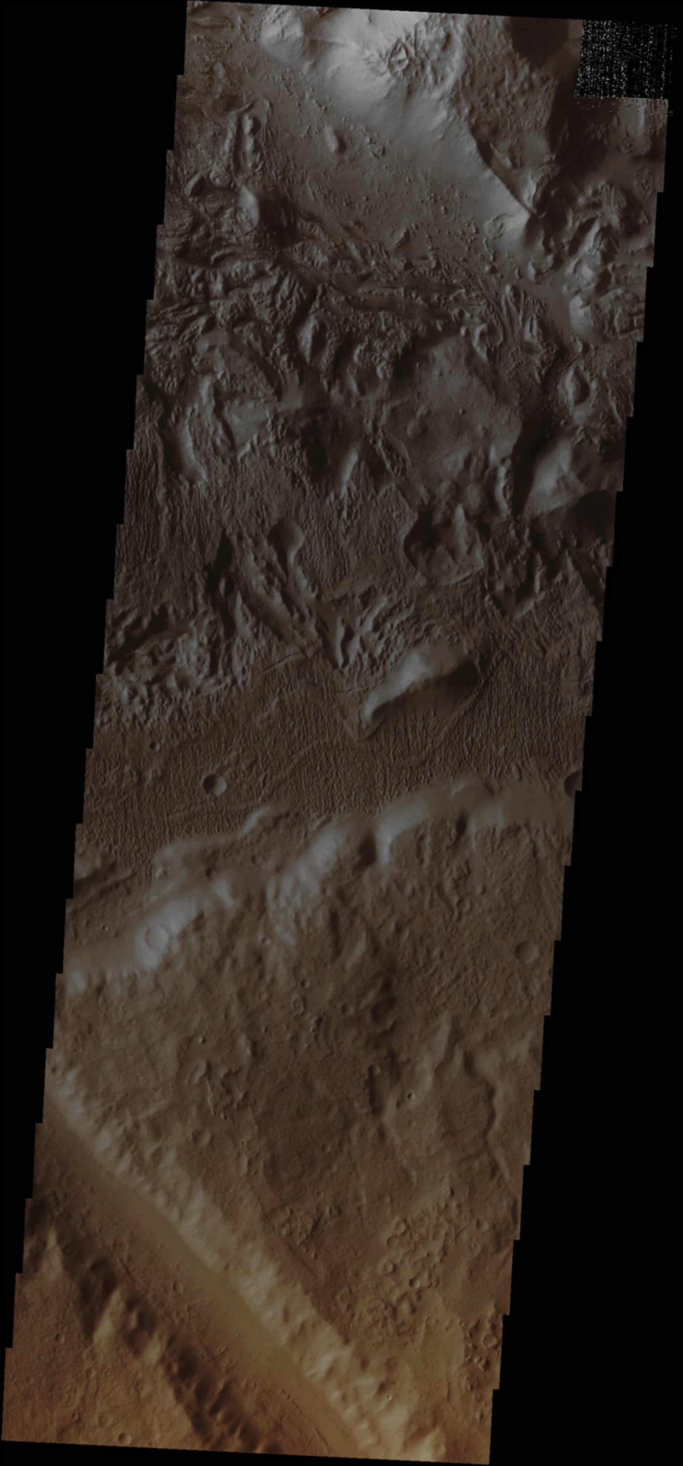
In this VIS image, taken by the NASA - Mars Odyssey Orbiter on October, 8th, 2013, and during its 52.402nd orbit around the Red Planet, we can see that the Surface Textures that were captured here - located to the South/East of Aeolis Planum - are, most likely, are the result of series of different Geological and Atmospherical Processes. Specifically, the Chaotic Surfaces visible in the upper side of the frame (i.e.: towards the North) are the product of the verification of some very ancient Tectonic Processess, while the Surface Features (better yet: Textures) found near the center of the frame (---> Yardangs), are the final result of a powerful (and still ongoing) Wind Action. A small section of a (possibly) Water-carved Channel can also be seen towards the bottom of the frame. Last, but not least, you may want to notice that only a few (dusty and ancient) Impact Craters can be found in this specific Martian location. Latitude (centered): 7,561° South This image (which is an Original Mars Odyssey Orbiter b/w and Map-Projected frame published on the NASA - Planetary Photojournal with the ID n. PIA 17709) has been additionally processed, magnified, contrast enhanced, Gamma corrected and then colorized in Absolute Natural Colors (such as the colors that a human eye would actually perceive if someone were onboard the NASA - Mars Odyssey Orbiter and then looked down, towards the Surface of Mars), by using an original technique created - and, in time, dramatically improved - by the Lunar Explorer Italia Team. |
News visualized: 820 times