October 25, 2013

Credits: NASA/JPL/Arizona State University (ASU) - Credits for the additional process. and color.: Dr Paolo C. Fienga/Lunar Explorer Italia/IPF
|
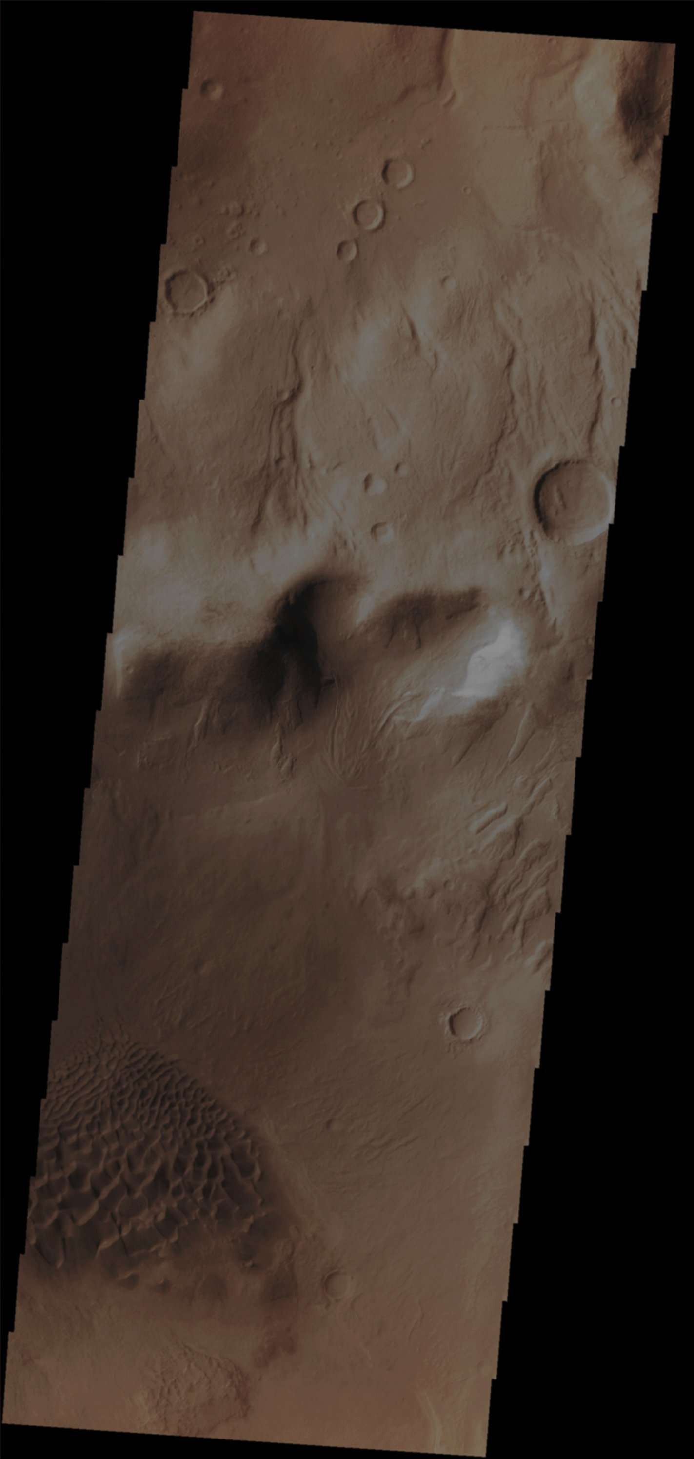
In this VIS image, taken by the NASA - Mars Odyssey Orbiter on August, 17th, 2013, and during its 51.797th orbit around the Red Planet, we can see a small portion of the Floor of Baltisk Crater (an ancient Impact Crater located in the Argyre Quadrangle of Mars, with its center at 42,7° South Latitude and 54,7° West Longitude). The diameter of Baltisk is approx. 52 Km - such as about 32,29 miles - and its name comes from an old Russian town. In the lower portion of the picture it can be seen a Sand Sheet (---> a small Dunefield) that covers part of the Floor of the Crater while, in the upper portion of the frame, we can see that there are quite a few (relatively) more recent (and small) Impact Craters, as well as several Channels dissecting the Outer Rim of Baltisk. Latitude (centered): 41,8923° South This image (which is an Original Mars Odyssey Orbiter b/w and Map-Projected frame published on the NASA - Planetary Photojournal with the ID n. PIA 17519) has been additionally processed, magnified, contrast enhanced, Gamma corrected and then colorized in Absolute Natural Colors (such as the colors that a human eye would actually perceive if someone were onboard the NASA - Mars Odyssey Orbiter and then looked down, towards the Surface of Mars), by using an original technique created - and, in time, dramatically improved - by the Lunar Explorer Italia Team. |
News visualized: 713 times