February 23, 2012

Credits: NASA/JPL/Arizona State University (ASU) - Credits for the additional process. and color.: Dr Paolo C. Fienga/Lunar Explorer Italia/IPF
|
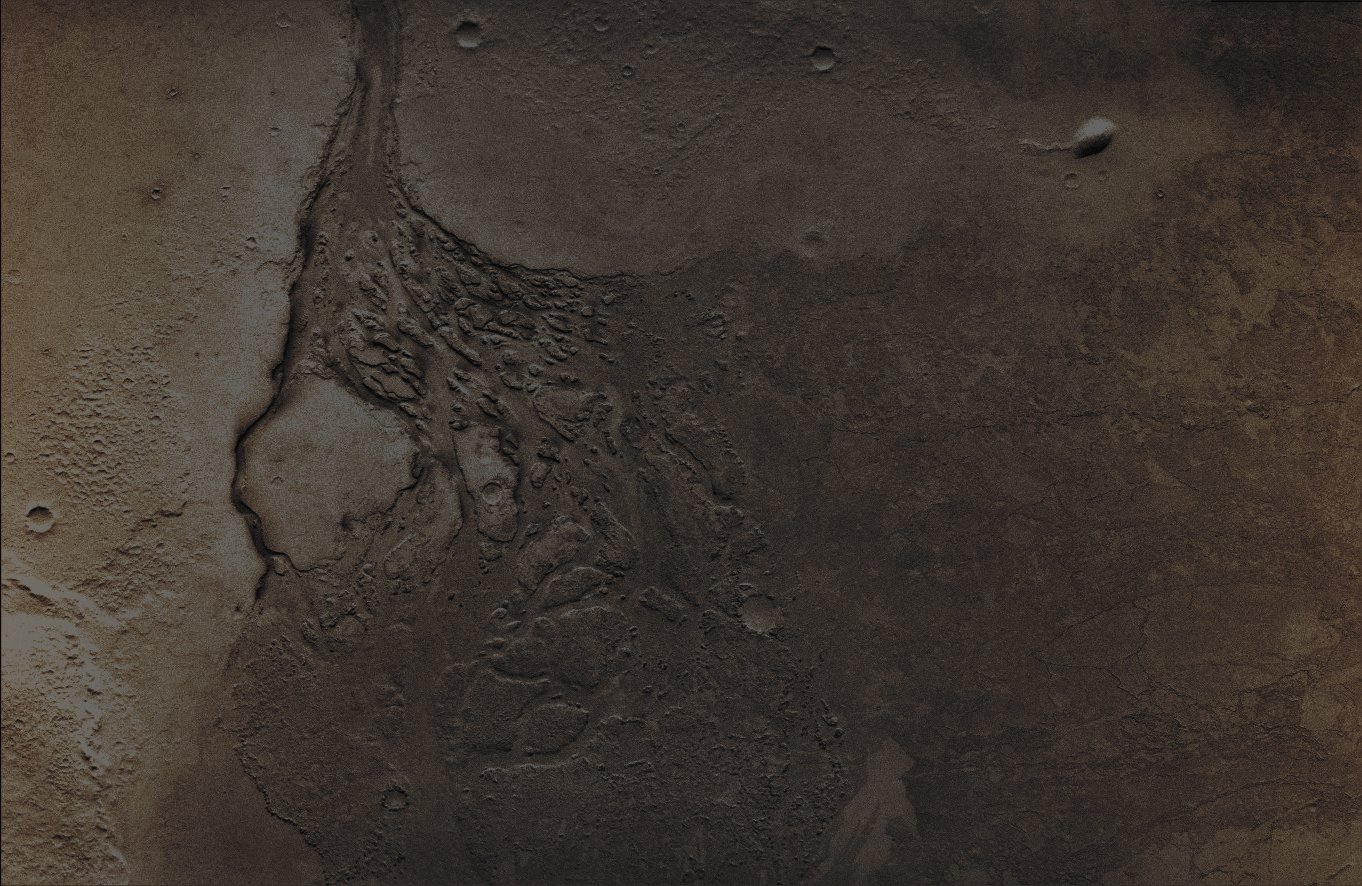
Lethe Vallis is an approximately 230 Km long and (in average) 1,5 Km wide, Sinuous Channel connecting two shallow Basins in the Elysium Planitia Region of Mars. Lethe is of particular interest because the Main Basin (known as "The Western Elysium Basin") from which it begins is fed by outflow from Athabasca Vallis, an about 300 Km long and (in average) approx. 30 Km wide, geologically recent, Catastrophic Flood-Carved Channel. Lethe therefore appears to be an overspill channel that formed as the Western Elysium Basin breached a topographic divide at its South-Western Margin. The Flood Deposits in this Region are marked by a distinctive platy-ridged-polygonised Surface Texture. NASA Scientists have mapped the extents of this texture in and around Lethe Vallis and, from this mapping, they have constructed topographic long profiles of Lethe's Thalweg (----> such as the deepest continuous inline within a Watercourse System) as well as of the Northern and Southern Contacts between the platy-ridged-polygonised sides of Lethe and some older Underlying Terrain. The upstream half of Lethe Vallis has a slightly concave topographic profile with a very shallow gradient of about 0,0001. The Distal Half of the Channel has a Slope about three times greater, with a stepped profile. These steps match the locations of Cataract Systems within the Channel and each Cataract System is defined by a series of amphitheatre-shaped Scarps heading along Inner Channels within the Main Valley. In plan view, the Lethe System is divided into four separate zones, defined by "constrictions" where the "contacts" draw close to the Channel Margins. Each of these constrictions marks the downstream end of a Basin, and are also associated with breaks in Slope of the contact long profiles. The cataracts are each located a few kilometres upstream of the Margins of the Basins, but the Inner Channels below the Head Scarps of the Cataracts terminate at the Basin Margins. In addition, the mapped contact for at least three of the Basins (and only not so for the smallest one) closely follow an Equipotential Surface, thus suggesting that the contacts are high-stand marks and indicate the verification of a phenomenon known as "Ponding". That, within Basins, both Northern and Southern contacts are at the same topographic height reinforces this view. The Cataracts therefore appear to represent upstream migration of knickpoints into Overflowing Fluvial Basins. In addition to the Cataract Systems, a variety of other landforms associated with Catastrophic Flooding are seen in Lethe Vallis, such as: Streamlined Islands, Anastomosing Distributary Systems, Fluvial Hanging Valleys and paired and unpaired Terraces on the Channel Margins. There are also possible Depositional Features, like Dunes and/or Anti-Dunes, located just downstream of the Cataracts and these Surface Features reinforce the Fluvial nature of the flow that carved the Lethe Channel and suggest that there was an Alluvial Element to the System. Palaeo-Discharge estimates based on the Channel Cross-Section and the Thalweg Slope are of the order of 1-5×10⁴ m3s-1 (therefore similar to the order of the flow in the Mississippi River on Earth). The volume of fluid within the high stand contacts in the largest of the zones divided by the Lethe System Discharge gives an estimate for the minimum length of time the System was active, such as from about 10 to 50 days, but it probably lasted much longer. In summary, the Geomorphology of Lethe Vallis points to formation as a fluvial 'Fill and Spill' Catastrophic Flood System. This fits in closely with the wider observations of the linked Basins within the Elysium Planitia Region. Image Data: VIS instrument Latitude: 4,8° North and 156,1° East Resolution: 18 meter/pixel. This frame has been colorized in Absolute Natural Colors by (such as the colors that a human eye would actually perceive if someone were onboard the Mars Odyssey Orbiter and then looked down, towards the Surface of Mars), by using an original technique created - and, in time, dramatically improved - by the Lunar Explorer Italia Team.
|
News visualized: 962 times