

March 19, 2013

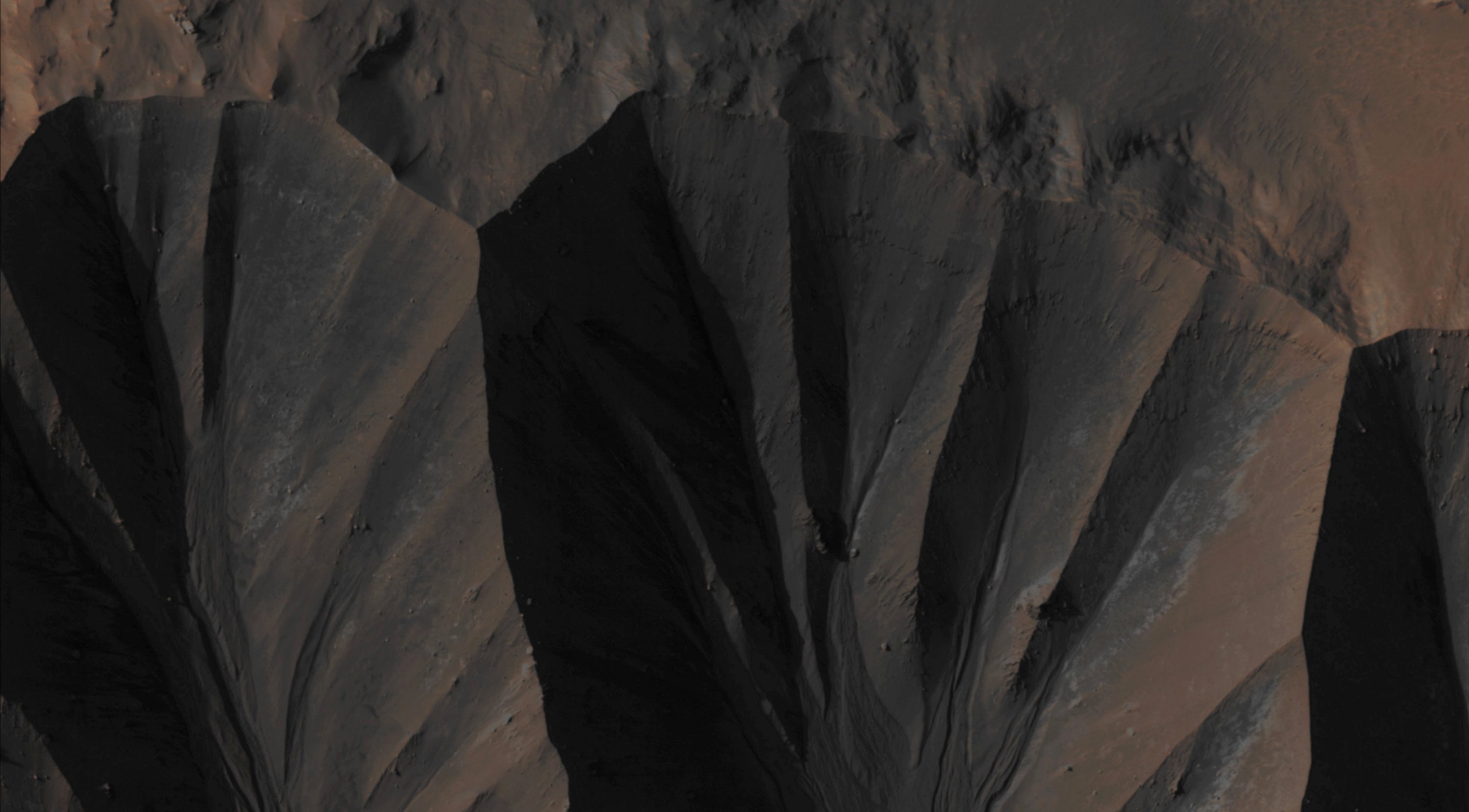
Credits: NASA/JPL/University of Arizona - Credits for the additional process. and color.: Dr Paolo C. Fienga/Lunar Explorer Italia/IPF
|
The so-called "Gully Landforms" - just like the ones shown here, in this NASA - Mars Reconnaissance Orbiter image - can often be found in the Inner Rims (or even below, along the Inner Slopes) of many Impact Craters that are located at the Martian Mid-Latitudes. Some changes in these Gully Landforms were first seen in frames taken by the NASA - Mars Global Surveyor - Mars Orbiter Camera (MGS-MOC) in the AD 2006, and studying such activity has been a high priority for HiRISE ever since (and, in fact, many examples of New Deposits located inside Gully Landforms are now well known). This frame shows a New Deposit inside some Gully Landforms located on the Inner Rim of Gasa Crater; a very (relatively speaking) "fresh" approx. 7-Km diameter Impact Crater that is found in the Southern Mid-Latitudes of the Red Planet (to be precise, at 35,72° South Latitude and 129.45° East Longitude). Said New Deposit appears of a distinctive gray color, with some patches of white Material too, in this Absolute Natural Color version of the NASA - Mars Reconnaissance Orbiter image n. ESP_020661_1440. The picture was acquired during the Southern Spring of Mars, but the Flow that formed the Deposit occurred in the preceding Winter. As a matter of fact, the current Gully Activities appear to be concentrated in periods going from the late Winter to the early Spring of Mars, and this circumstance may be a consequence of the Sublimation of the Seasonal Carbon Dioxide (CO2) Frost (which, by the way, is well visible in several Gully "Alcoves" during Wintertime). Mars Local Time: 15:49 (Middle Afternoon) This picture (which is an Original Mars Reconnaissance Orbiter EDM enhanced color frame, identified by the serial n. ESP_020661_1440) has been additionally processed and then re-colorized in Absolute Natural Colors (such as the colors that a human eye would actually perceive if someone were onboard the NASA - Mars Reconnaissance Orbiter and then looked down, towards the Surface of Mars), by using an original technique created - and, in time, dramatically improved - by the Lunar Explorer Italia Team. |
News visualized: 892 times