January 29, 2012

Credits: NASA/JPL/University of Arizona - Credits for the additional process. and color.: Dr Paolo C. Fienga/Lunar Explorer Italia/IPF
|
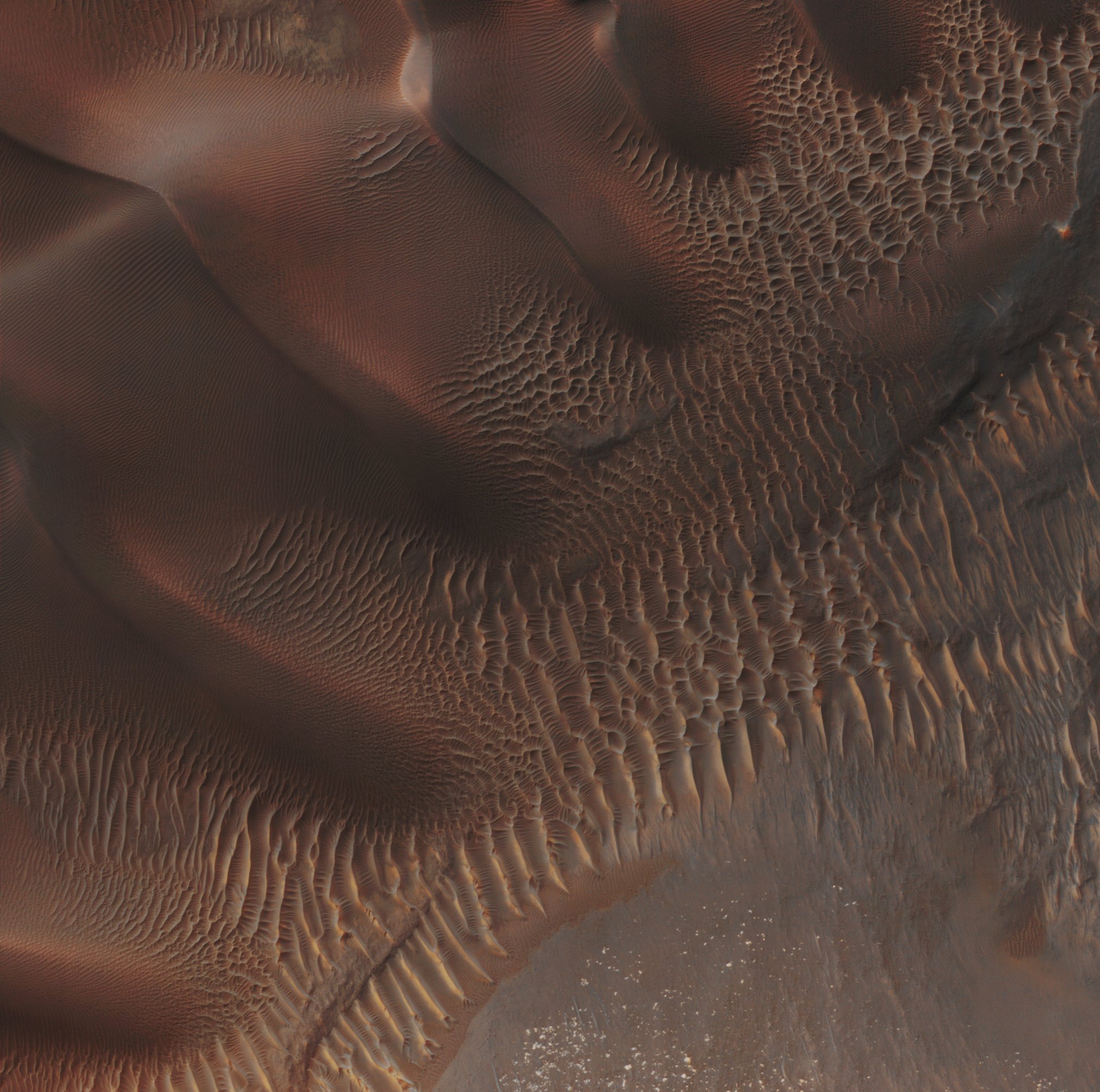
Sand Dunes and Ripples are, jointly with Windstreaks and Yardangs, probably the most common and widespread Aeolian (meaning "wind-formed") Features present on Mars. Their spatial distribution and morphology are affected by changes in Wind direction and Wind strength. Furthermore, patterns of Dune Erosion and Deposition may often provide insight into the Sedimentary History of the Terrain surrounding them. This image shows Sand Dunes trapped in an Unnamed Impact Crater located in the Southern Region known as Noachis Terra. Note, also, among the Dunes and Sand Ripples visible in this frame, the presence of several Rocky Outcrops (all having a blue-graysh color) and, in the lower section of the picture, the evidence of a cluster of white, high-albedo minerals, shining in the Sun of the early Martian afternoon. This frame has been colorized in Absolute Natural Colors (such as the colors that a human eye would actually perceive if someone were onboard the Mars Reconnaissance Orbiter and then looked down towards the Surface of Mars), by using an original technique created - and, in time, dramatically improved - by the Lunar Explorer Italia Team.
|
News visualized: 821 times