July 17, 2012

Credits: NASA/JPL-Caltech - Phoenix Lander Mission - Credits for the additional process. and color.: Elisabetta Bonora and Marco Faccin/Lunar Explorer Italia/IPF
|
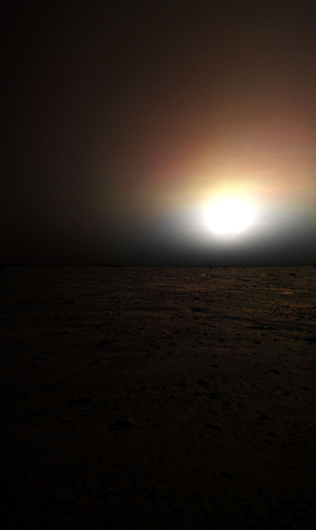
Vastitas Borealis is the largest Lowland Region of Mars; it is located in the Northerly Latitudes of the Red Planet and it encircles its entire Northern Polar Regions. Remember, just to be aware of what you read or see, that the Martian Region of Vastitas Borealis is often simply named and referred to as "The Northern Plains" and/or "The Northern Lowlands" of Mars. The Plains lie about 4–5 Km below the Mean Radius of the Red Planet and, to the North, lies the so-called Planum Boreum. The Region was so named by the Greek Astronomer Eugène Michel Antoniadi (March, 1st, 1870 – February, 10th, 1944), who noted the distinct Albedo Feature of the Northern Plains in his book (La Planète Mars - published in the AD 1930). The name was also officially adopted by the International Astronomical Union (IAU) in the AD 1973. Two distinct Basins can be recognized within the Region of Vastitas Borealis: the North Polar Basin and Utopia Planitia. Some scientists have (we believe, as IPF, reasonably) speculated that the Plains were once covered by an Ocean (a dating is impossible and so we have to say that such an Ocean might have been there just "at some point in Mars' history") and Putative Shorelines have also been suggested (and, somehow, defined) for its Southern Edges. Today, these mildly sloping Plains are marked by Ridges, low Hills, and sparse (---> rare and uneven) Cratering; furthermore, Vastitas Borealis is noticeably smoother than similar Topographical Areas located in the Southern Hemisphere of Mars. In the AD 2005, the European Space Agency's (ESA) Mars Express Spacecraft imaged something that looked like a "Substantial Quantity of Water Ice" lying at the bottom of an Unnamed Crater (some time afterwards named "Lauth Crater") which is located in the Vastitas Borealis Region. Even though the environmental conditions existing in the area where this Surface Feature (such as the so-called "Lake of Vastitas Borealis") was imaged are suitable for Water Ice to remain relatively stable in time, we, as IPF, do believe that the alleged "Substantial Quantity of Water Ice" (as the ESA defined it) that should have characterized the inside of Louth Crater, is just an extremely thin (maybe just a few millimeters thick) layer of "Persitent Frost" that covers its (almost always) frozen Floor. The NASA - Phoenix Spacecraft landed safely in the Region of Vastitas Borealis (in an area that has been unofficially named "Green Valley") on May 25, 2008 (such as in the early Northern Martian Summer). Phoenix landed at 68,218830° North Latitude and 234,250778° East Longitude. The Lander, which remained fully operational for about 5 (five) months - and that now shall remain in the exact spot where it landed for the centuries (and more) to come -, collected and analyzed several Soil Samples in an effort to detect the presence of Water in that area as well as to determine how hospitable the Red Planet might (once) have been for some Indigenous Earth-like Lifeform to be born and grow there. In today's APOD, a realistic view of the Horizon of Vastitas Borealis (as seen by the camera onboard the NASA - Phoenix Lander), around midnight (Mars Local Solar Time). The actual luminosity of the panorama has NOT been enhanced in any way. This frame has been colorized in Natural Colors (such as the colors that a perfect human eye - or an Electronic Eye - would actually perceive if someone were near the NASA - Phoenix Lander and then looked towards the Horizon and Sky of Mars), by using an original technique created - and, in time, dramatically improved - by the Lunar Explorer Italia Team. |
News visualized: 797 times