July 14, 2012

Credits: NASA/JPL/USGS and Voyager 2 Project - Credits for the additional process. and color.: Dr Paolo C. Fienga/Lunar Explorer Italia/IPF
|
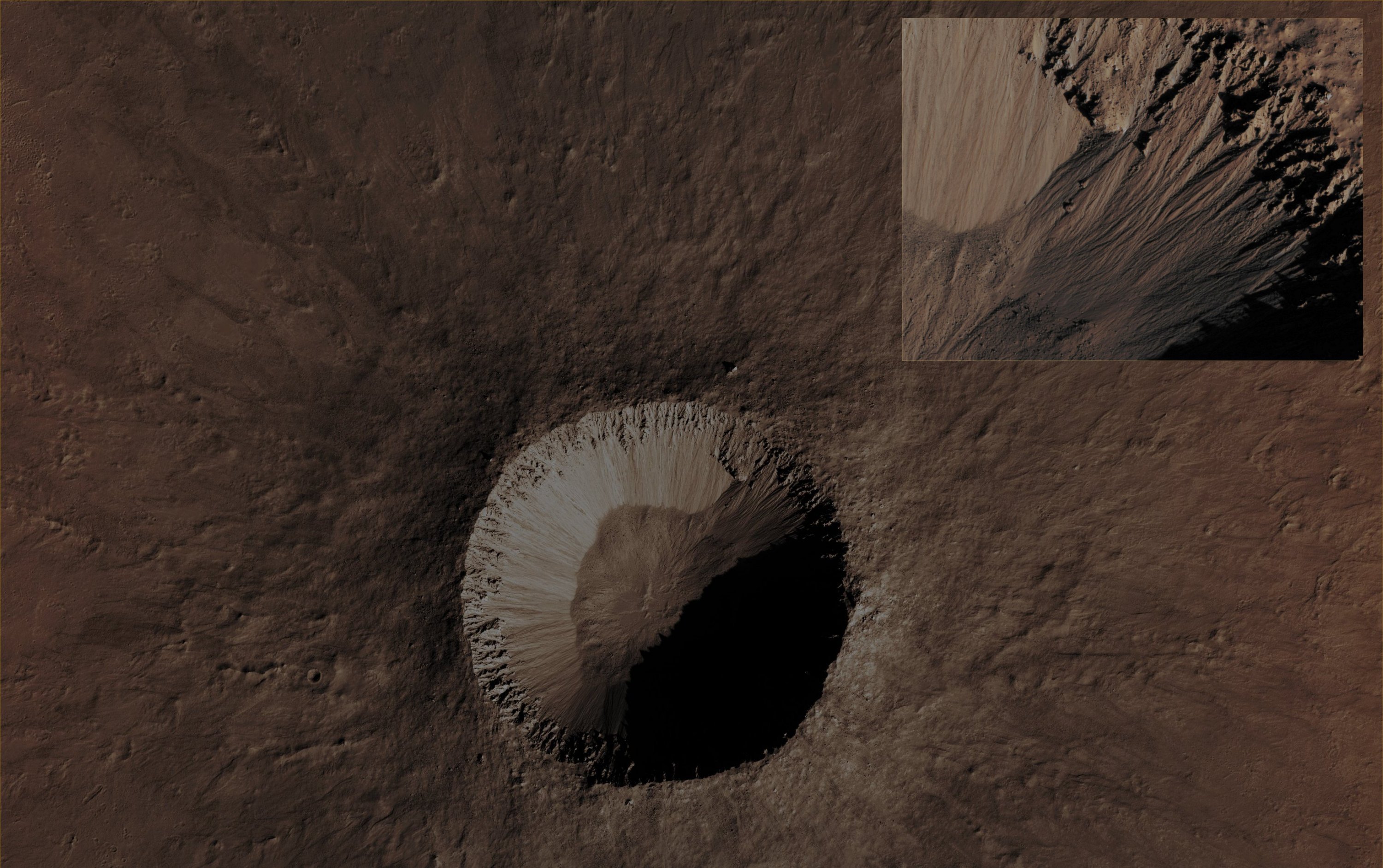
This image (such as the Contextual - or "CTX" - Frame) covers an area where we can see a (Geologically speaking) "fresh-looking" Impact Crater, located at about 35° South Latitude and having a diameter of about 2 Km (approx. 1,2 miles). As you can see, there are quite deep Gullies all around its steep Inner Slopes , and they can even be seen in the shadowed portion of the Crater, just by enhancing the brightness of that region. The fact that there are Gullies all around the circumference of the Crater, is very unsual, since many (probably almost all the) Impact Craters located at this Latitude of the Southern Hemisphere of Mars only have Gullies on their South-facing Slopes, which are almost completely shadowed during Wintertime. But this is an especially pristine Impact Crater and so its Inner Slopes may well still be particularly steep and, in a way, even unstable. The NASA - Mars Reconnaissance Orbiter will monitor this Site in the future, so to see if the Gullies have changed and, therefore, if they are still currently active (which, however, is an extremely likely possibility, and even though we do not know - nor we have ways, for now, to find out - if such an activity is water-related or not). Said that, its age is (probably) less than a Million Years. Note that the Ejecta Blanket includes a "Herringbone" (---> a "spina di pesce") Texture, with V-shaped Features that are all pointing to the Source Crater. Mars Local Time: 14:48 (Early Afternoon) This frame has been colorized in Absolute Natural Colors by (such as the colors that a human eye would actually perceive if someone were onboard the NASA - Mars Reconnaissance Orbiter and then looked down, towards the Surface of Mars), by using an original technique created - and, in time, dramatically improved - by the Lunar Explorer Italia Team.
|
News visualized: 814 times