June 30, 2012

Credits: NASA/JPL/University of Arizona - Credits for the additional process. and color.: Dr Paolo C. Fienga/Lunar Explorer Italia/IPF
|
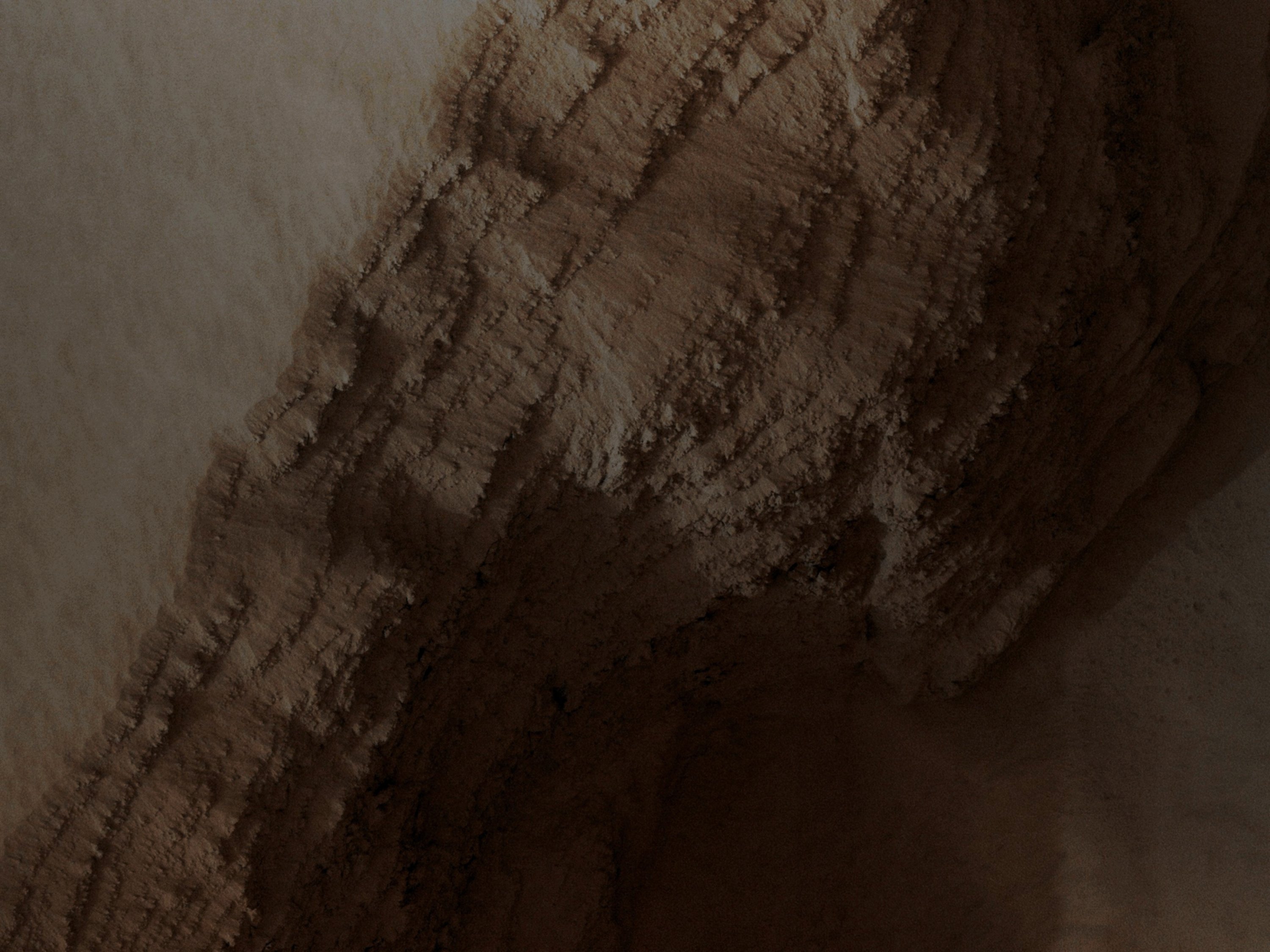
This image - taken by the NASA - Mars Reconnaissance Orbiter and dated July, 18th, 2007 - shows us a few details of the Inner Wall a Collapse Pit located in the lower West Flank of Arsia Mons, such as one of the 4 (four) Giant Volcanoes of the Tharsis Volcanic District. A lot of Layers are exposed in the Walls of the Pit, probably marking individual Lava Flows, and so they can provide us with useful information about the nature of some of the many Martian Volcanic Eruptions. Furthermore, the picture was acquired just in the middle of a large Regional Dust Storm, but the Atmosphere over this specific Surface Detail, as you can easily notice, is only moderately dusty, and that is because the altitude of the Feature is something like 6,5 Km higher than the Planetary Mean, so the Air, over there, is quite thin and it cannot hold as much Dust as it does at lower altitudes. However, even if the Atmosphere was not too dusty, the Surface Feature that we are looking at is actually semi-buried by a Dust Layer which is probably several meters thick. These high-altitude locations on Mars have thick Dust Deposits because the thin Air cannot blow away the Dust, or at least not as fast as it accumulates. On Earth the Oceans serve as "Dust Traps", but on Mars, this "job" is for the highest Volcanoes (as well as for the highest Volcanic Plateaux) only. Mars Local Time: 14:50 (Early Afternoon) This frame has been colorized in Absolute Natural Colors by (such as the colors that a human eye would actually perceive if someone were onboard the NASA - Mars Reconnaissance Orbiter and then looked down, towards the Surface of Mars), by using an original technique created - and, in time, dramatically improved - by the Lunar Explorer Italia Team. |
News visualized: 743 times