April 30, 2012

Credits: NASA/JPL/Arizona State University (ASU) - Credits for the additional process. and color.: Dr Paolo C. Fienga/Lunar Explorer Italia/IPF
|
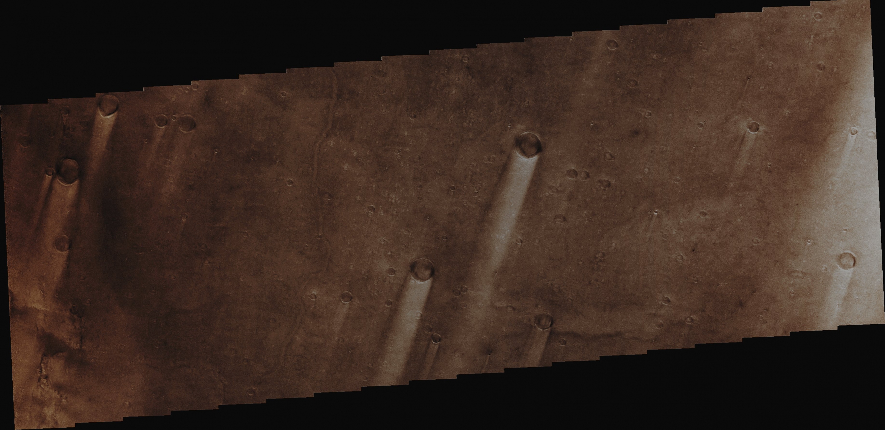
Syrtis Major Planum is actually a "Dark Spot" (---> Albedo Feature) located at the boundary between the Northern Lowlands and the Southern Highlands of Mars. Based on the data collected (among others) by the NASA - Mars Global Surveyor Orbiter, it has been speculated and then theorized that this whole Region could reasonably be a low-relief Shield Volcano (remember that, in the past, Mars' Scientists thought that this Region was just a Dark Plain - and, as a matter of fact, this whole Martian Area was then known as Syrtis Major Planitia). The very dark color which characterizes Syrtis Major Planum is due to two main factors: first, the Basaltic Volcanic Rock, which is largely present all over the Region, and, second, the relative lack of that Borwn-Orange Dust which covers most of the Red Planet. Syrtis Major Planum is centered at approx. 8° 24' North Lat. and 69° 30' East Long.; it extends approx. 1500 Km (such as about 930 miles) North from the Planet's Equator, and spans about 1000 Km (approx. 620 miles) from West to East. This Region, which gives its name to the Geographic Quadrangle that it is located in (---> the Syrtis Major Quadrangle), encompasses a large Slope that, from its Western Edge (Aeria Planitia), lowers of about 4 Km (approx. 2,5 miles) before reaching the Eastern one (Isidis Planitia). Syrtis Major Planum includes a high-altitude Bulge that rises approx. 6 Km (3,7 miles) and that it is located at about 310° West Long. Most part of Syrtis Major Planum has Slopes of less than 1°: such as a much lower inclination than the Slopes of the Tharsis Shield Volcanoes. Syrtis Major Planum also shows an approx. 350 x 150 Km North-South elongated Central Depression containing two ancient Volcanoes, named Nili and Meroe Patera (both about 2 Km deep). The Floors of these Pateras are not elevated (considering the average altitude of the Terrain surrounding them). Furthermore, the Floor of Nili Patera is the less cratered of the two, which makes it, from a geological point of view, the younger one. While most of the Rock of Syrtis Major Planum is Basaltic, some Dacite has also been detected in Nili Patera. In addition to that, the Gravity Field Measurements that have been performed throughout some of the Spacecrafts orbiting around Mars, has showed a Positive Gravity Anomaly centered right on the Caldera Complex, suggesting the presence of an about 600 x 300 Km North-South elongated (and now completely extinct) Magma Chamber below, which shoulod contain heavy and dense Minerals like, probably, Pyroxene, with Olivine also possible. Minerals that precipitated out of the Magma before the eruptions. Crater counts date Syrtis Major Planum to the early Hesperian Period and it postdates the formation of the adjacent Isidis Impact Basin. Syrtis Major Planum was the object of much observation due to its seasonal and long-term color variations. This (however unusual) circumstance, led, at the very beginning of the research, to theories that this Region could have been a shallow sea; afterwards, instead, it was theorized that its variability might have been due to seasonal vegetation. However, in the 1960s and 1970s, the NASA - Mariner and Viking Probes led scientists to conclude that the color variations were caused by powerful Winds, blowing Dust and Sand all across the area. Like we can see in today's APOD, Syrtis Major Planum is litterally covered by windblown Sand and Dust Deposits, as well as by both light and dark-colored Streaks that form downwind of Impact Craters (and which are the so-called, and very famous on Mars, Aeolian Features known as Windstreaks). These Windstreaks, if you watch them carefully, are nothing else but accumulations of Dust and fine-grained Sand, resulting from the disruption of the Windflows by the elevated Rims of the Craters themselves. Orbit Number: 42965; Latitude: 7,5511° North; Longitude: 69,5825° East; Instrument: VIS; Captured: August, 22nd, 2011. This frame has been colorized in Absolute Natural Colors (such as the colors that a human eye would actually perceive if someone were onboard the NASA - Mars Odyssey Orbiter and then looked down towards the Surface of Mars), by using an original technique created - and, in time, dramatically improved - by the Lunar Explorer Italia Team.
|
News visualized: 906 times