April 6, 2012

Credits: NASA/Johns Hopkins University Applied Physics Laboratory/Carnegie Institution of Washington and Dr Paolo C. Fienga/LXTT/IPF for the additional process. and color.
|
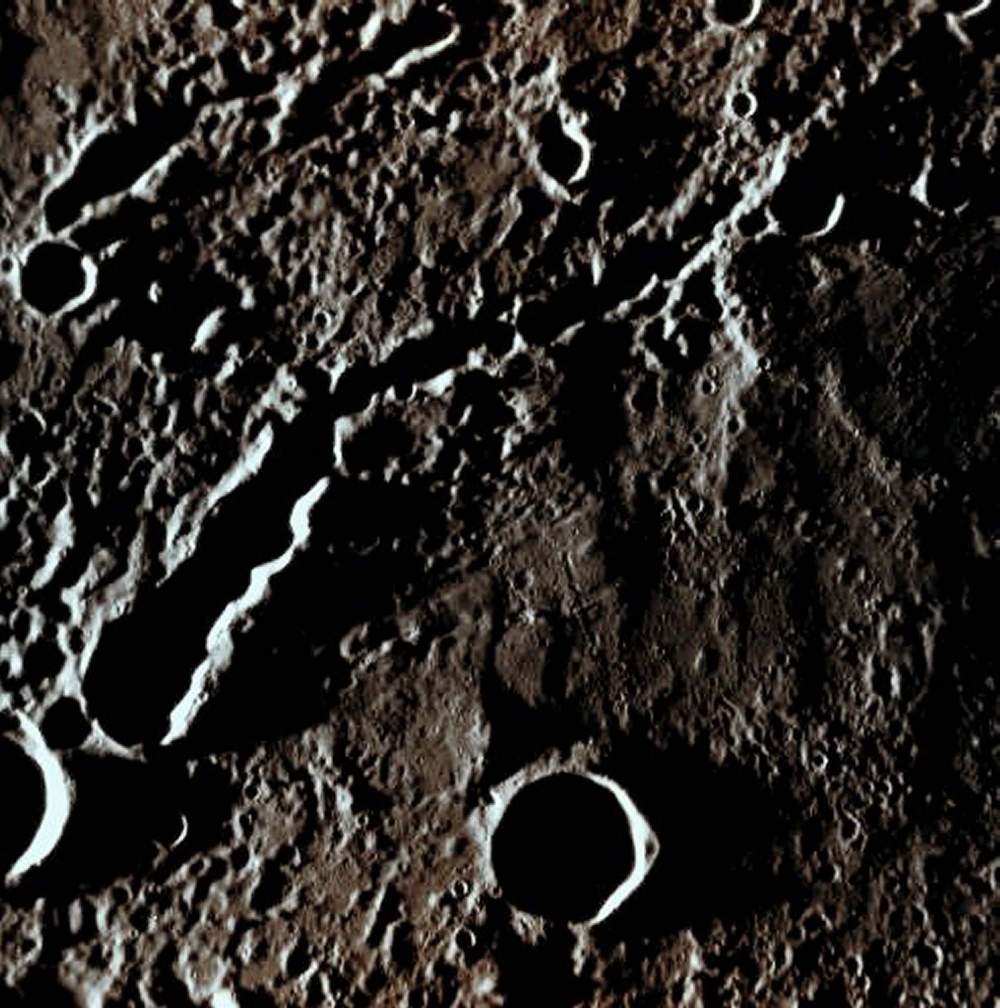
This image, taken with the Narrow Angle Camera (NAC) onboard NASA - MESSENGER Spacecraft, now orbiting the Planet Mercury, shows a pair of (possibly Secondary) Crater Chains. These kind of Surface Features are formed, for instance (and like our NASA Friends suggest for the case in point), when Ejecta (meaning rocks and boulders belonging to the Impacted Celestial Body) deriving from a Primary Impact, are thrown up and outward from the Growing Cater Cavity; as the Ejecta fall back onto the Surface, they can form Chains of Secondary Craters that - sometimes - may also overlap. However, another possibility for these specific Surface Features to form, is when a flock of Meteorites (or maybe just a huge one that broke into pieces during the fall, or right before the impact) strikes the Surface of a Celestial Body according to a so-called Straight Sequential Impact Line (in other words, just imagine a series of Impactors striking the Surface of Mercury in sequence, one after the other, with all of them having almost identical Impact Angles and all of them impacting in accordance to a - relatively - straight line). One last (but certainly not the least...) possibility for a Crater Chain (like the one we are showing you in today's APOD) to form, is because of a Cometary Impact. In this specific case, as we have said hereabove, our NASA Friends, once all the above possibilities were given, opted for a Secondary Craters Chain, and we, as IPF, may also agree with that (even though that option is certainly NOT our first choice). Anyway, what was the exact scientific reason that the decision made by the NASA Scientists for this case was based on, unfortunately, it is impossible for us to say. This frame has been colorized in Absolute Natural Colors (such as the colors that a human eye would actually perceive if someone were onboard the NASA - MESSENGER Spacecraft and then looked down, towards the Surface of Mercury), by using an original technique created - and, in time, dramatically improved - by the Lunar Explorer Italia Team.
|
News visualized: 759 times