January 16, 2015

Credits: NASA/JPL/Arizona State University (ASU) - Credits for the additional process. and color.: Dr Paolo C. Fienga/Lunar Explorer Italia/IPF
|
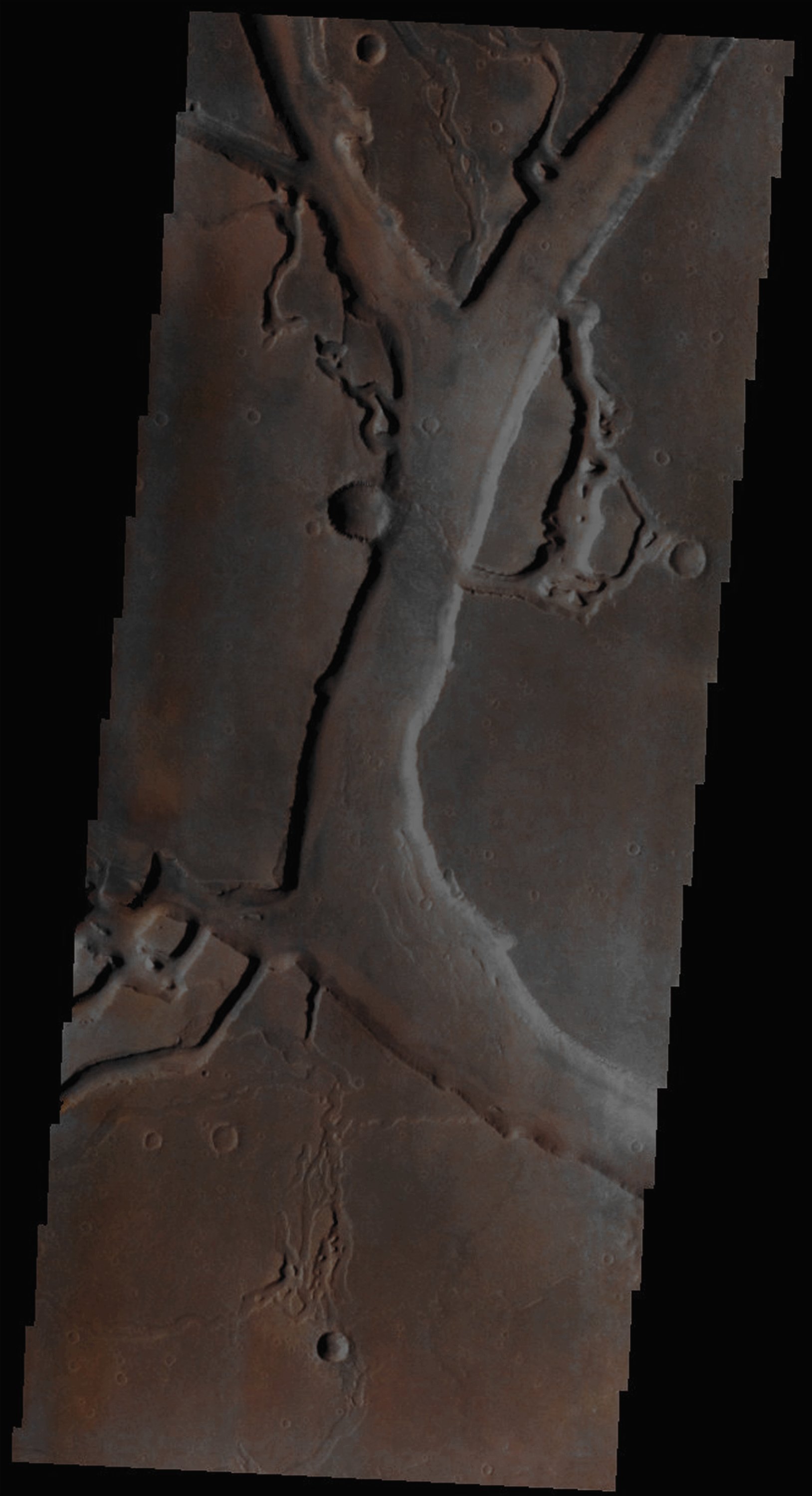
In this beautiful VIS image, taken by the NASA - Mars Odyssey Orbiter on July, 27tth, 2002, and during its 2.729th orbit around the Red Planet, we can see a very small section of the long and sinuous Martian Outflow Channels' System (most likley carved by Water) known as Granicus Valles (after an ancient Turkish name for "river"). Granicus Valles is approx. 750 Km (such as about 465,75 miles) long and it is located in the Amenthes Quadrangle of Mars at about 30° North Latitude and 229° West Longitude. The complexity of this Channels' System (characterized, among other things, by the presence of several Streamlined Islands) can easily be noticed even just by taking a good look at this small section of it and, as far as its formation is concerned, once we consider the (relative) lack of (at least visible) Impact Craters, we believe - as IPF - that it should be, of course, always Geologically speaking, relatively recent. Latitude (centered): 26,5888° North This image (which is an Original Mars Odyssey Orbiter false colors and Map-Projected frame published on the NASA - Planetary Photojournal with the ID n. PIA 19010) has been additionally processed, magnified to aid the visibility of the details, contrast enhanced and sharpened, Gamma corrected and then re-colorized in Absolute Natural Colors (such as the colors that a normal human eye would actually perceive if someone were onboard the NASA - Mars Odyssey Orbiter and then looked down, towards the Surface of Mars), by using an original technique created - and, in time, dramatically improved - by the Lunar Explorer Italia Team. |
News visualized: 863 times